infoDiagram
>
Maps
>
Balkan Europe Maps with Administrative Regions (Serbia, BiH, Montenegro… PPT editable)
>
Balkan Countries BIH, MNE, ALB, MKD, SRB Territories
Balkan Countries BIH, MNE, ALB, MKD, SRB Territories
from deck
Balkan Europe Maps with Administrative Regions (Serbia, BiH, Montenegro… PPT editable)
- Info
- How To Edit
- Usage example
Info
Balkan Countries (BIH, MNE, ALB, MKD, SRB) Territories
(white on dark background)
Slide Content
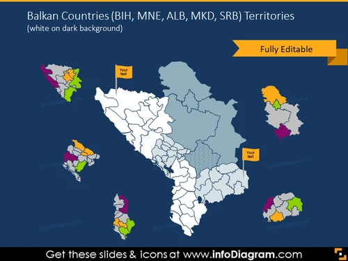
The slide presents a collection of map graphics representing the territories of Balkan countries - Bosnia and Herzegovina (BIH), Montenegro (MNE), Albania (ALB), North Macedonia (MKD), and Serbia (SRB). Each country's map is color-coded, showcasing its geographical region in the Balkans. Each map segment comes with a text box for customization, labeled "Your text" to add specific information about that area.
Graphical Look
- The slide has a dark blue background providing high contrast for other elements.
- In the center, there is a large, main map outline encompassing the Balkan region, with country borders delineated in white.
- Small, colorful map vignettes of individual Balkan countries are arranged around the central map.
- Each small map has multiple colors representing different regions or divisions within the countries.
- Colored text boxes are positioned adjacent to the small maps inviting the presenter to add custom text.
- On the top right corner, there's a yellow-orange banner with the words "Fully Editable".
The slide features a clean and professional design, with clear visual separation of each country's territory through outlined maps and color-coding. The use of color blocks and editable text boxes allows for easy customization.
Use Cases
- To present geographical data about specific Balkan countries in educational settings or seminars.
- To showcase market regions or business territories within these countries in business presentations.
- Highlighting regional political boundaries or discussing historical changes within the Balkan Peninsula.
- For NGOs or international organizations to display regional focus areas for projects or aid work in the Balkans.
How To Edit
How to edit text & colors

How to expand / shorten diagram

How to Replace Icons in infoDiagram PPT


