Financial Decks
Visualize your results with ease
Sweden administrative division region map
from deck
Nordic Europe Maps with Administrative Territories (PPT editable)
Info
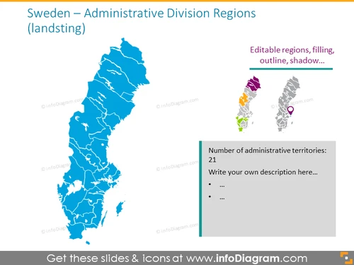
Sweden – Administrative Division Regions (landsting)
Slide Content
The slide is focused on the administrative division of Sweden, particularly its landsting or regions. It features a large map of Sweden divided into its various regions, each delineated clearly to show the boundaries. To the right, there's a smaller panel that emphasizes the editable nature of the region's graphics, mentioning customization options like filling, outline, and shadow. Below this, a text box indicates Sweden's division into 21 administrative territories and encourages the viewer to add a custom description.
Graphical Look
- Central focus on a large, blue map of Sweden displaying administrative boundaries
- Contrasting sidebar with different region colors showcasing editability
- Feature callouts on the sidebar with lines pointing to specific regions on map for emphasis
- Text box with a heading in bold, followed by two bullet points for additional information
- Simplified, stylized icons are placed beside the editable regions, symbolizing customization options
- A harmonious blend of a central image with supporting sidebar content for clear communication
The slide presents a crisp and professional look with distinct coloring and clean lines for easy understanding and visualization. The complementary text and icons provide context and instructions for customization.
Use Cases
- Presenting regional statistics or data analysis for Sweden in a business meeting.
- Discussing regional market penetration or sales figures in a marketing strategy presentation.
- Displaying geographical distribution of resources, branches, or operations in a corporate presentation.
- Educational purposes to demonstrate the geographical political divisions within Sweden.


