Financial Decks
Visualize your results with ease
Africa Map PPTX symbol Morocco Egypt Flight Water Transport
from deck
Maps of African Countries (PPT icons Population, GDP, transport)
Info
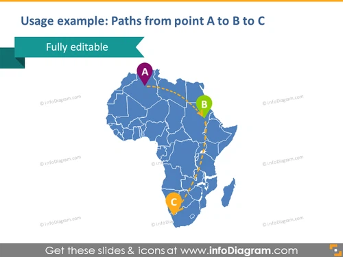
Usage example: Paths from point A to B to C
Slide Content
The slide presents a graphic illustration showing possible paths or connections between three points marked as A, B, and C on the map of Africa. Each point is represented by a colored circle with a letter inside, and the paths are shown as dotted lines. Points A and B are connected, as well as points B and C, indicating a sequence or process that moves from A through B to C.
Graphical Look
- A large map of Africa in blue with white outlining for country borders
- Three circles in purple (A), green (B), and orange (C) to represent different points
- Dotted lines in yellow connect the circles, depicting paths or routes
- A large, bold title in dark blue font that reads "Usage example: Paths from point A to B to C"
- A turquoise-colored banner in the top left corner with text "Fully editable"
The slide has a clean and professional appearance, utilizing a color scheme that contrasts well against the blue map. The simplicity of the design directs focus to the paths and points of interest on the map.
Use Cases
- Illustrating logistics routes or supply chain movements between different locations
- Showing strategic expansion plans for businesses into new markets
- Mapping out travel itineraries or tours that cover multiple destinations
- Demonstrating regional market research or data flow between different areas


